SERVICE / GEO-SPATIAL MAPPING
Every Farmer Mapped. Every Field Connected. Every Acre Accounted For.
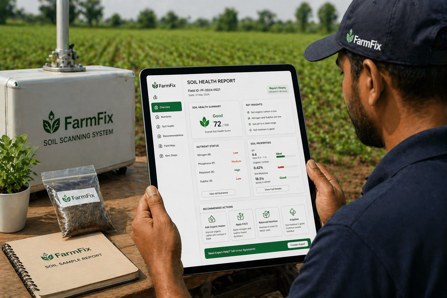
FarmFix builds GPS-mapped digital records for every farmer and plot - connecting your land, your crop, your season, and your activity into one verified system.
Step by Step
Each step builds on the last to create a complete, connected record.
Farmers are onboarded into FarmFix
Farmer name, location, contact, land details, and crop history are captured into a clean digital profile.
Farmer details are verified and organized
Records are cross-checked, deduplicated, and added to your FPO, cluster, or crop program database.
Plot boundaries are captured using GPS
Field teams visit each plot and use GPS to map exact boundaries, area, and field coordinates.
Each field receives a unique digital record
Every plot gets its own ID, linked to the farmer, location, season, and active crop program.
Crop and season are linked to every field
Crop type, sowing date, and seasonal context are connected to the plot for full agronomic awareness.
Field records become the base for monitoring and traceability
Every future activity links back to the mapped plot, creating a single source of truth.
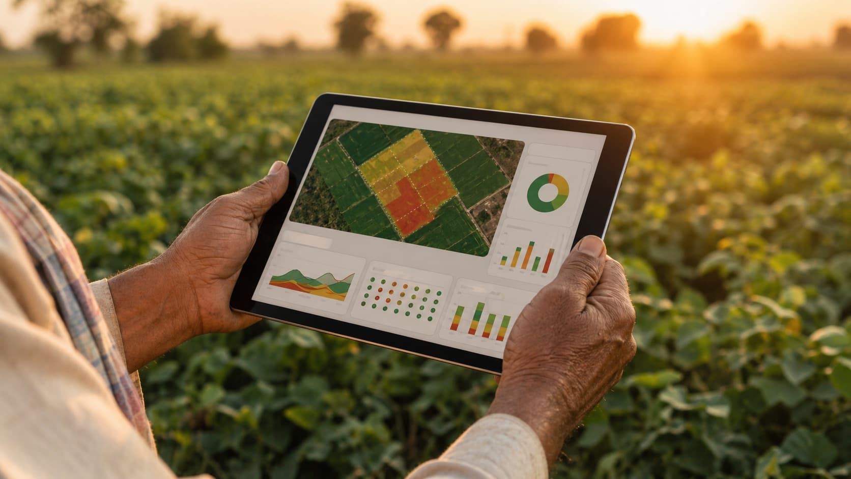
Cluster-level views are unlocked for FPOs and crop teams
Procurement managers and crop programs get cluster-wide dashboards across mapped farmer networks.
- 1
Farmers are onboarded into FarmFix
Farmer name, location, contact, land details, and crop history are captured into a clean digital profile.
- 2
Farmer details are verified and organized
Records are cross-checked, deduplicated, and added to your FPO, cluster, or crop program database.
- 3
Plot boundaries are captured using GPS
Field teams visit each plot and use GPS to map exact boundaries, area, and field coordinates.
- 4
Each field receives a unique digital record
Every plot gets its own ID, linked to the farmer, location, season, and active crop program.
- 5
Crop and season are linked to every field
Crop type, sowing date, and seasonal context are connected to the plot for full agronomic awareness.
- 6
Field records become the base for monitoring and traceability
Every future activity links back to the mapped plot, creating a single source of truth.
- 7
Cluster-level views are unlocked for FPOs and crop teams
Procurement managers and crop programs get cluster-wide dashboards across mapped farmer networks.
How Mapping Becomes Infrastructure
A farmer record without a mapped field is just a contact entry. A field without a farmer is just a polygon. FarmFix connects both - every farmer profile is GPS-linked to a real plot boundary, and every plot is tied to crop, season, soil data, and activity.
This is the digital infrastructure most Indian agriculture has been missing. Notebooks, WhatsApp messages, and standalone Excel sheets cannot deliver cluster visibility, traceability, or cross-season analysis. FarmFix replaces them with one connected, searchable, scalable system.
For FPOs and agribusinesses, this means moving from approximate member counts to verified cluster maps. For exporters and processors, it means every sourcing conversation can start with proof of origin - down to the specific acre.
What This Helps With
- Verified farmer and field identity
- Clear cluster and sourcing visibility
- Stronger traceability foundation
- Reduced manual record gaps
- Better link between field activity and batch records
- AI-ready field data for every acre